Plate tectonics is the scientific theory that Earth's outer shell is broken into a set of large, rigid plates that drift slowly over the hotter, weaker mantle beneath them. It is the organizing framework of modern geology, explaining why earthquakes and volcanoes cluster where they do, how mountains rise, and how continents have rearranged themselves across hundreds of millions of years.
In 1912 the German scientist Alfred Wegener proposed that the continents had once been joined in a single landmass and had since drifted apart. He pointed to the jigsaw fit of Africa and South America, matching fossils on opposite coasts, and shared rock formations. The idea was widely rejected for decades because Wegener could not say what force could move a continent.
The answer arrived in the 1950s and 1960s, when surveys of the ocean floor revealed mid-ocean ridges where new crust forms and spreads outward, and symmetric magnetic stripes recorded in the rock confirmed that the seafloor was moving. By the late 1960s the evidence was overwhelming, and continental drift was absorbed into the broader, mechanism-rich theory of plate tectonics.
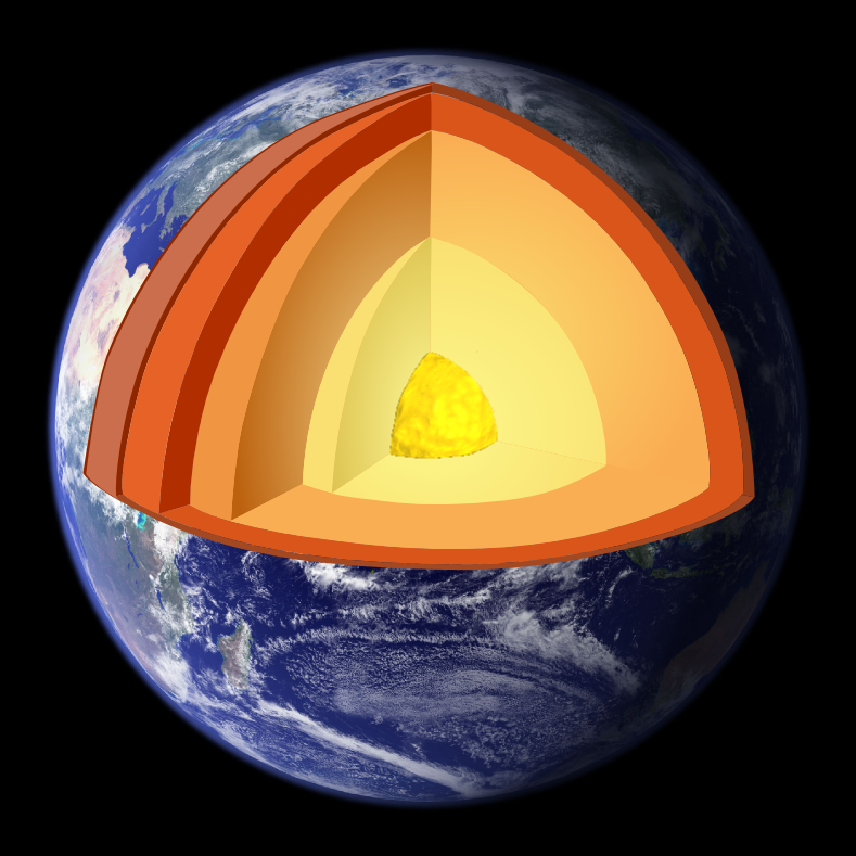
The theory holds that Earth's rigid lithosphere is divided into roughly a dozen major plates and several smaller ones. These plates ride on the slowly flowing asthenosphere below, driven mainly by the pull of dense, cold slabs sinking back into the mantle at subduction zones, aided by convection and the push of spreading ridges. Motion is gradual, a few centimetres a year, about as fast as fingernails grow.
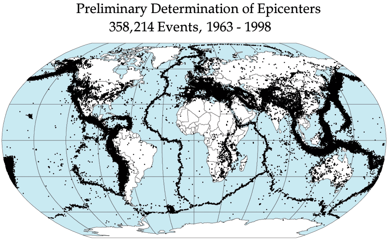
Where plates meet, the planet records their motion. Plotting the world's earthquakes traces the plate boundaries almost perfectly, outlining each plate as a jagged seam of seismic activity.
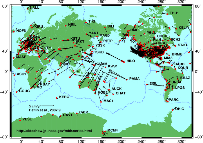
Today satellite positioning measures plate motion directly, confirming the speeds and directions the theory predicts down to the millimetre. This direct measurement turned a once-controversial idea into one of the most thoroughly verified frameworks in the Earth sciences.
Plates interact in three ways. At divergent boundaries they pull apart and new crust forms, as along the Mid-Atlantic Ridge. At convergent boundaries they collide, building mountain ranges such as the Himalayas or driving one plate beneath another to feed volcanoes. At transform boundaries they grind past each other, as along California's San Andreas Fault. Almost every dramatic feature of Earth's surface can be traced to one of these three encounters.