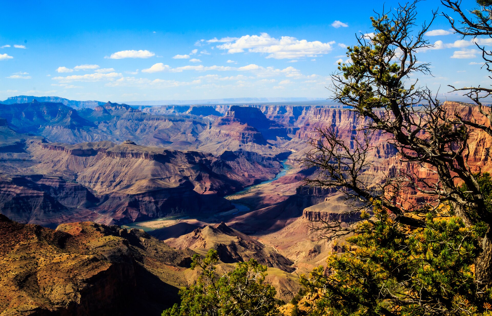
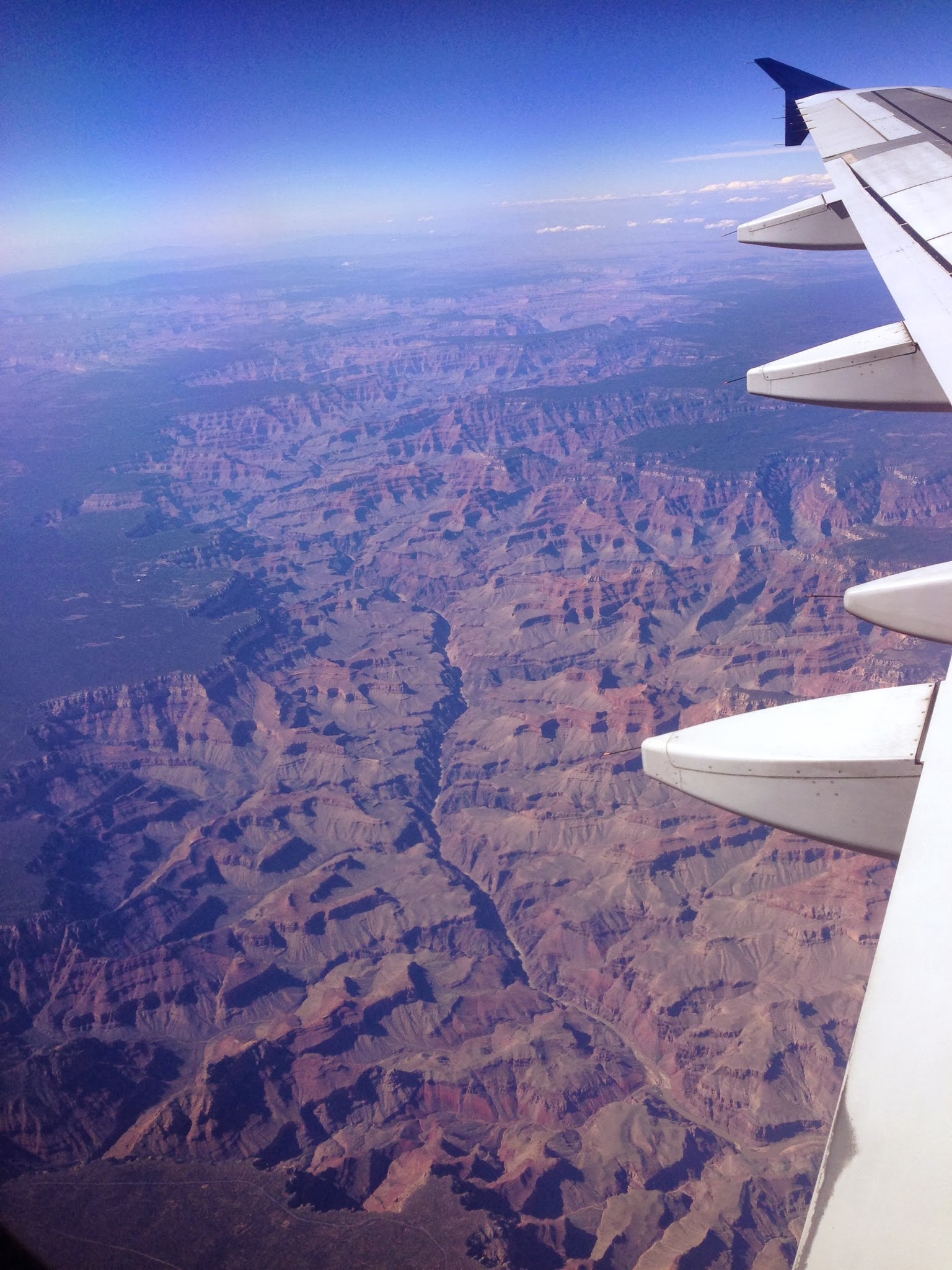
The Grand Canyon is one of the most spectacular landscapes on Earth: an immense gorge carved by the Colorado River through the high plateau of northern Arizona. About 446 kilometres long, up to 29 kilometres wide, and more than a mile (over 1,800 metres) deep, it lays bare nearly two billion years of the planet's history in its banded walls.
The Grand Canyon was cut, over the last several million years, by the Colorado River grinding downward through layer after layer of rock. As the surrounding land was slowly pushed upward, the river kept pace, slicing ever deeper, until it had carved the mile-deep chasm we see today.
The dry climate is part of what makes the canyon so striking. With little rain to soften and round the slopes, the walls remain steep, sharp, and exposed, and the sparse vegetation leaves the rock bare to view. The result is a cross-section through the crust revealed with a clarity rare anywhere else on Earth.
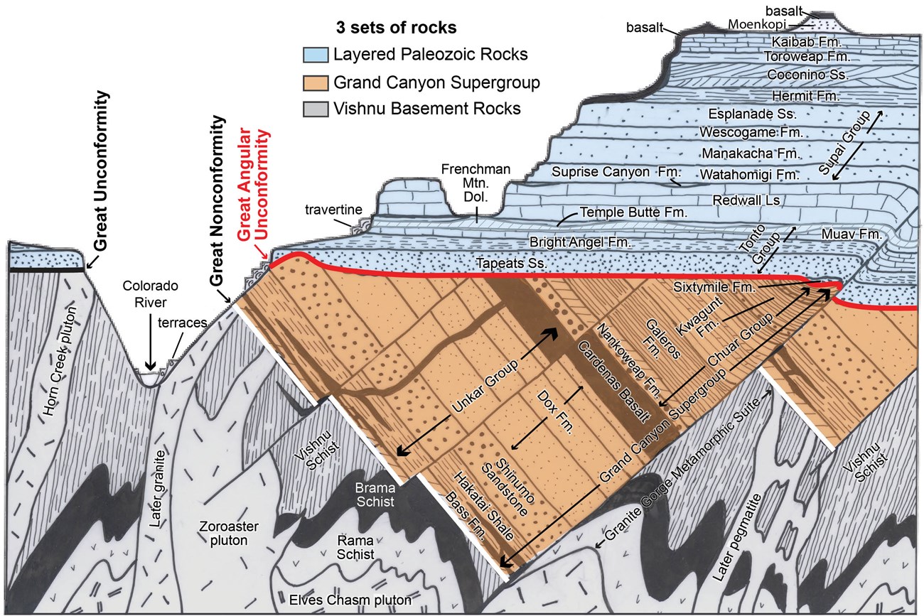
The canyon's walls are like the pages of an enormous book of Earth's history. Each band of rock represents a different chapter, ancient seas, deserts, and swamps preserved as limestone, sandstone, and shale, stacked one atop another over hundreds of millions of years, down to the dark, twisted rocks at the bottom that are nearly two billion years old.
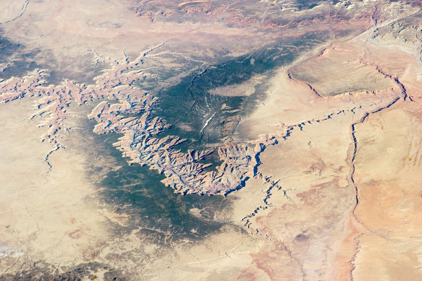
The Grand Canyon is on such a scale that it is a recognisable feature from orbit, its branching side canyons spreading like the veins of a leaf across the Arizona plateau. Astronauts on the International Space Station have photographed it from hundreds of kilometres up, one of the few river-carved landforms so easily picked out from space.
The Grand Canyon has been home to humans for thousands of years, and several Native American tribes have deep ancestral and continuing ties to it, regarding it as a sacred place. European awareness came much later, and in 1869 the explorer John Wesley Powell led the first recorded expedition by boat through its rapids. Today it is protected as a national park and a UNESCO World Heritage Site.
Far from a barren chasm, the Grand Canyon spans a remarkable range of environments, from cool forests on its high rims to desert at the river's edge, supporting a wide variety of plants and animals, including rare condors that once again soar above it. The change in climate from rim to river is as great as travelling from Canada to Mexico.
The Colorado River that made the canyon remains its lifeline, but it is one of the most heavily used rivers in the world. Dams upstream have altered its flow, temperature, and load of sediment, changing the canyon's ecology in ways scientists are still working to understand and manage, even as demand for the river's water keeps growing.